Hiking in London
In London
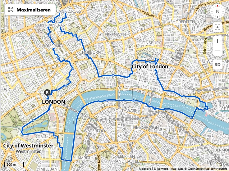
Jubilee Walkway
Jubilee Walkway: A walk through London opened for the silver jubilee of Queen Elizabeth.
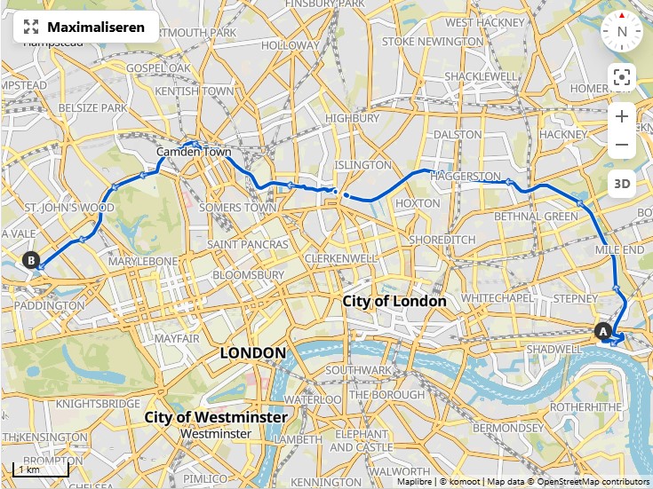
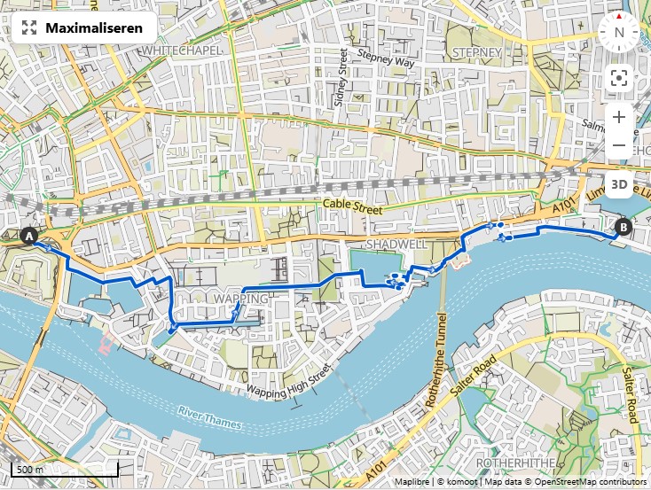
Regent's canal
-
Stations:
- Limehouse DLR station (zone 2)
- Warwick Avenue (zone 2)
-
Main walk:
- Walk can start at the Limehouse DLR station near the Limehouse Basin
- Ends near Paddington and Little Venice where it connects to another canal that may be worth following to, e.g., Kensal Green.
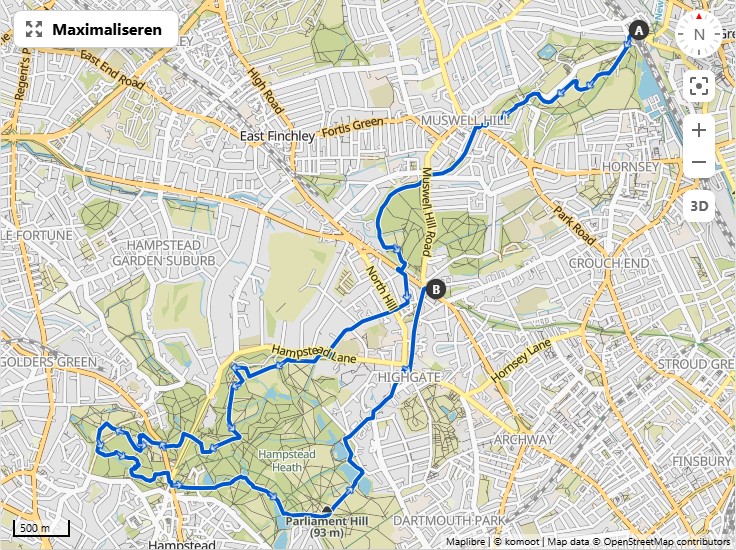
Hampstead Heath - Highgate - Alexandra
Walks through the Heath
- Stations:
- Highgate Tube Station (zone 3) (Northern line)
- Archway Underground Station (zone TODO) (Northern line)
- Alexandra Palace Station (zone TODO): No tube, only rail by Great Northern and Thameslink. The nearest tube station would be Turnpike Lane on the Piccadilly line
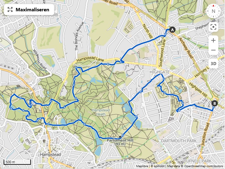
It turns out that the route through the cemetery is not possible though as there is only one (paid) entrance.
-
Walks on AllTrails and Komoot:
-
Notes:
- Depending on the time, it may be a good idea to make a detour and grab a small lunch at King William IV, one of the oldest gay pubs. (lunch served noon till 4pm) The evening menu is well worth it too.
Shorter walks partly along a former railway
-
In the neighbourhood of Hampstead Heath: A green walk from Finsbury Park over the Parkland Walk to Alexandra Palace.
-
Stations:
- Finsbury Park station (zone 2) (Piccadilly and Victoria lines)
- Turnpile Lane station (zone TODO) (Piccadilly line)
- Alexandra Palace Station (zone TODO): No tube, only rail by Great Northern and Thameslink. The nearest tube station would be Turnpike Lane on the Piccadilly line
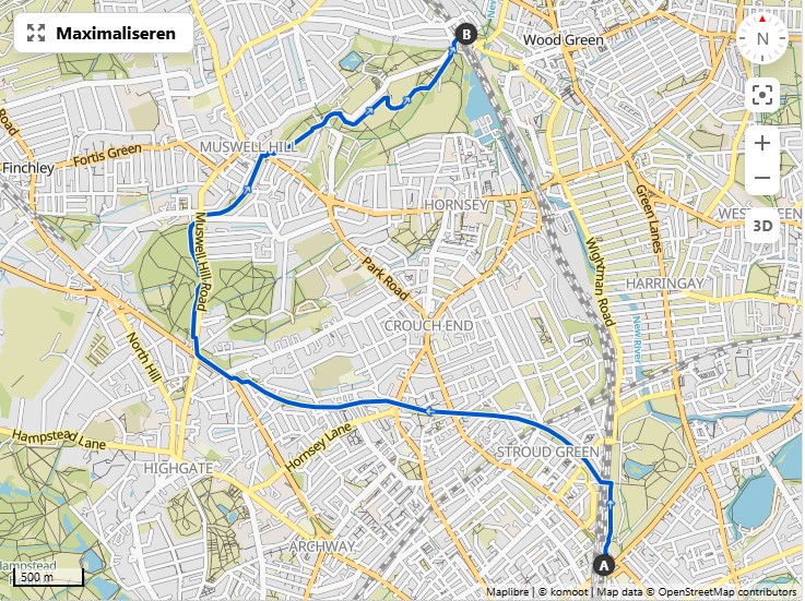
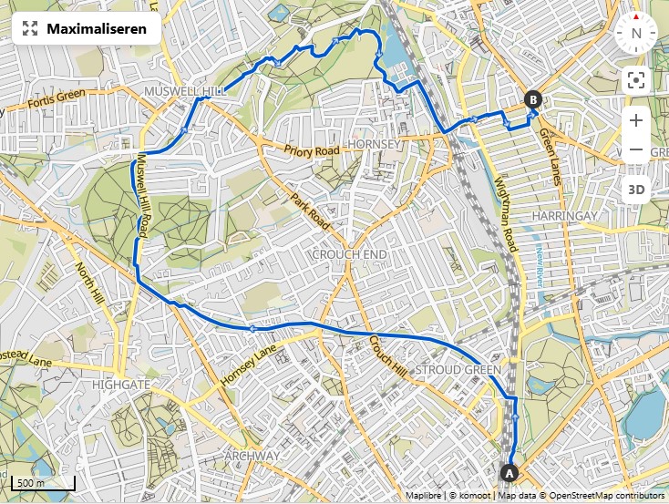
- Walks on Alltrails and Komoot:
- Parkland Walk: Finsbury Park to Alexandra Park on AllTrails through a nice green corridor.
- Similar walk but circular: Alexandra Palace & Highgate Wood loop from Finsbury Park on Komoot
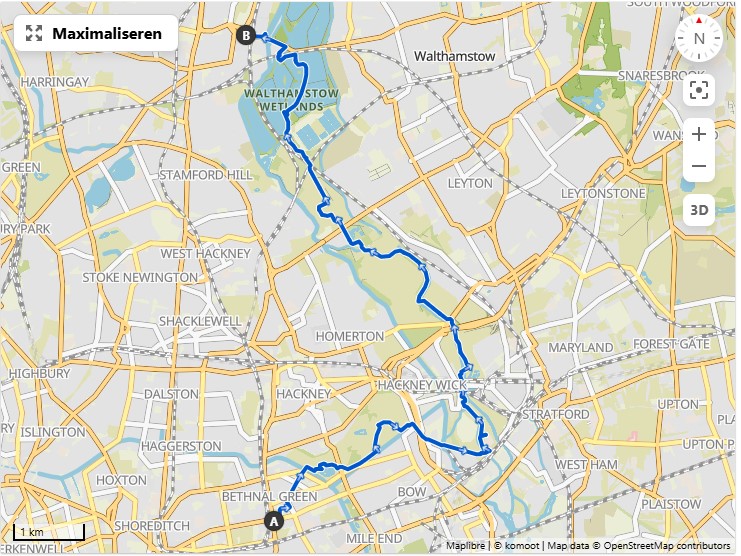
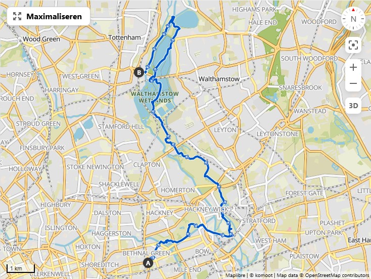
Walthamstow Marches and Wetlands and surrounding areas
Walthamstow Marches and Wetlands, combined with Victoria Park and the Olympics site
- Places:
- Inspiration on hiking sites:
- Walthamstow Marshes & Walthamstow Wetlands loop from Tottenham Hale on Komoot and it should be possible to extend this walk further towards the Northeast.
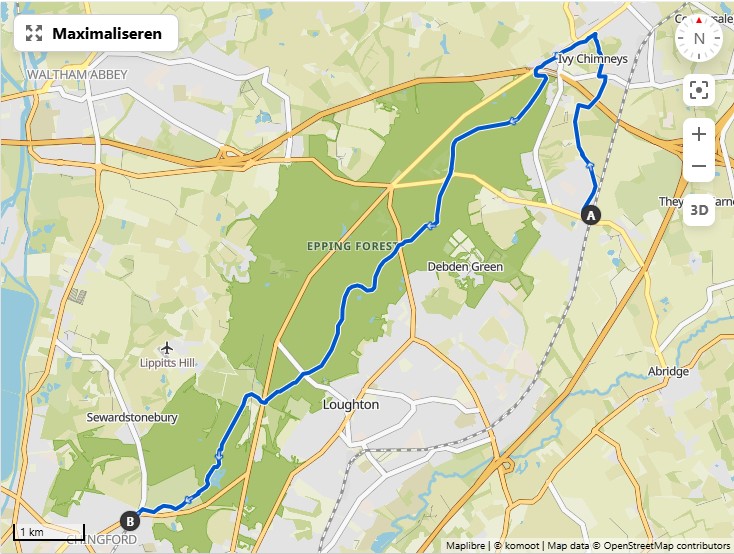
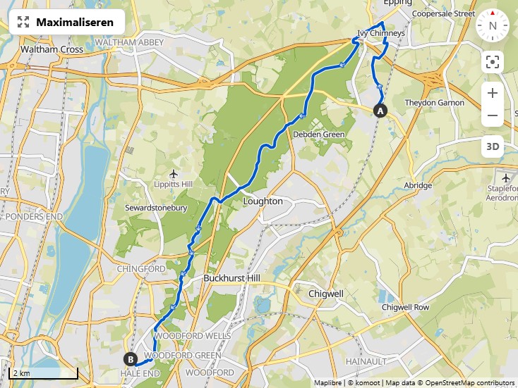
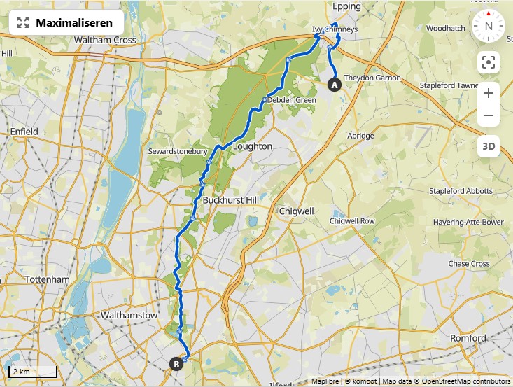
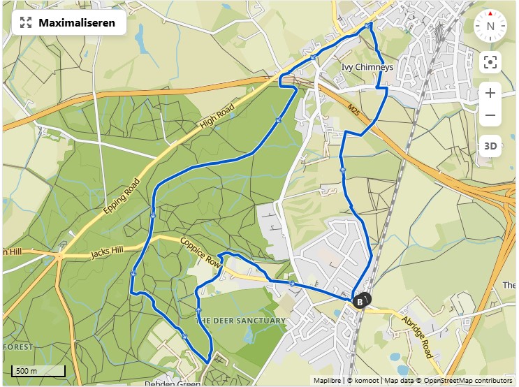
Epping Forest
Start- and end points
- Theydon Bois tube station (zone 6), (Central line)
- Chingford station (zone 5) (Overground)
- Highams Park station (zone 4) (Overground)
- Leytonstone tube station (border zone 3 and 4) (Central line)
- Enfield Lock Rail Station (zone 6) (greateranglia train service)
- Turkey Street station (zone 6) (Overground)
Set 1: From Theydon Bois along the length of the forest
If you start in Theydon Bois, you can decide along the way where to stop depending on the mood.
Set 2: Other walks

-
GPX from Turkey Street Station to Theydon Bois tube station (18.4km)
-
GPX from Teydon Bois tube station to Turkey Street Station (18.4km)
-
Notes
- Alternative starting point: Enfield Lock station
- This is a walk with many nice parts but also some parts that are not so pleasant or where the actual path is hard to find as it is not a main path that is frequented a lot. The version here already has some improvements based on how the walk was done at the end in 2024.
Specific issues with this route variant - The path along the Lee River Flood Relief channel is not very interesting and by the end of the summer overgrown with nettles and blackberry bushes. - The path from Yardley Hill to Yates Meadow is very hard to find. Yates Meadow offers a very nice view onto London, especially in its Western half, and hence is worth doing. - The paths from Bury Road to Connaught Water are also likely unofficial paths that often fade away in the forest. Some improvement there would be desired also.
The version offered here is already a sligthly improved version based on the route actually taken in 2024, but does not yet contain the other improvements.
Other sources for walks
- OS maps: A slightly different variant of the Oak trail.
- Chingford Plain & Connaught Water loop from Chingford - Epping Forest
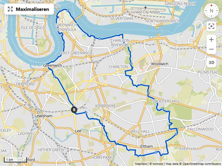
Greenwich and Woolwich
Stations
- Greenwich (zone ⅔): DLR, Thameslink and Sourtheastern.
- Woolwich Dockyard station (zone TODO): Southeastern
- Blackheath train station (zone TODO): Thameslink and Southeastern
- Woolwich station (zone TODO): Elisabeth line
- Abbey Wood station (zone 4): Elisabeth line, Thameslink and Southeastern.
- Charlton station (zone 3): Thameslink and Southeastern
Own preparations:
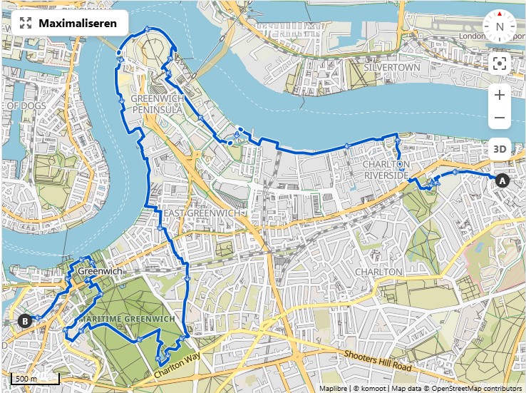
Walk from Woolwich Dockyard station to Greenwich station, going first along the Thames and the O2 Arena, then following some parks to Greenwich Park and with a stop at the Richard the first pub, back to Greenwich with the Old Royal Naval College and Greenwich Market.
Done the walk in 2023.
The counterclockwise variant may be the most interesting one as that one ends at Greenwich Park.
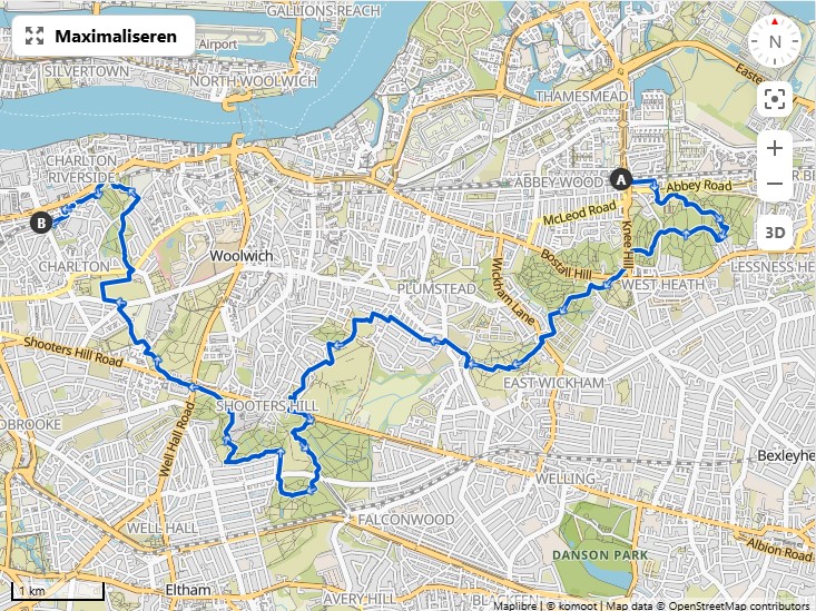
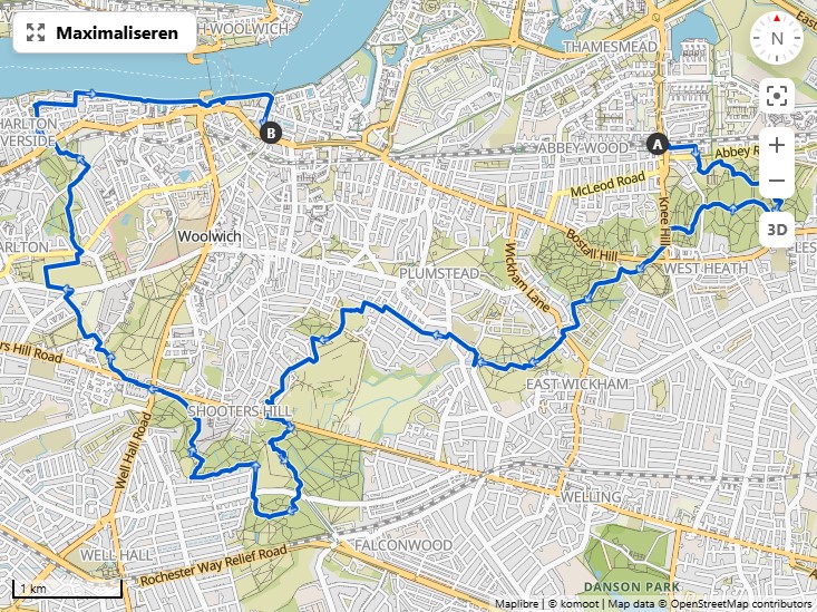
Walks from Abbey Wood over Severndroog castle
Revised based on the walk done in 2024.
Other options
- From the Tower to Greenwich: base upon Komoot Tower Bridge of Londen - Loop from Mudchute
Brixton and Dulwich
- Stations:
- Brixton tube station(zone 2): Victoria line
- Herne Hill station (zione ⅔): Thameslink and Southeastern
Walk: Brockwell Park, Dulwich Park and Sydenham Hill Woods loop.
Options:
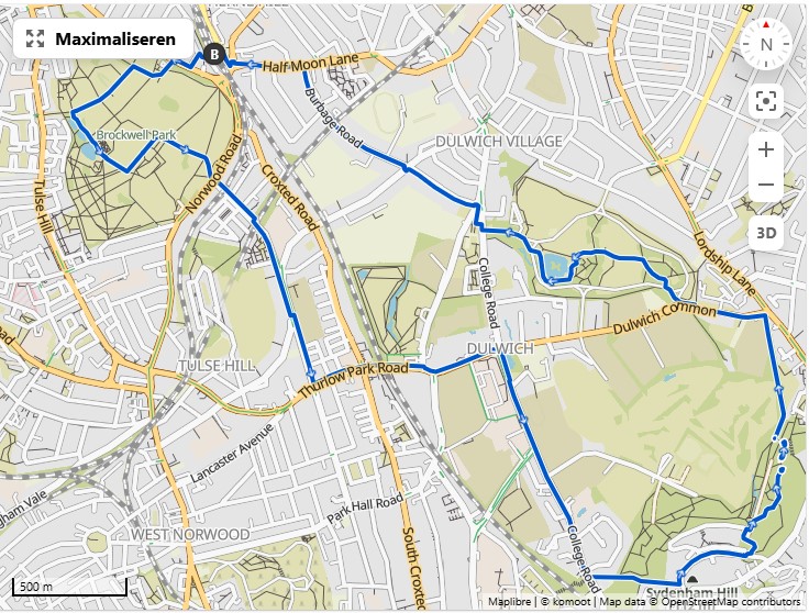
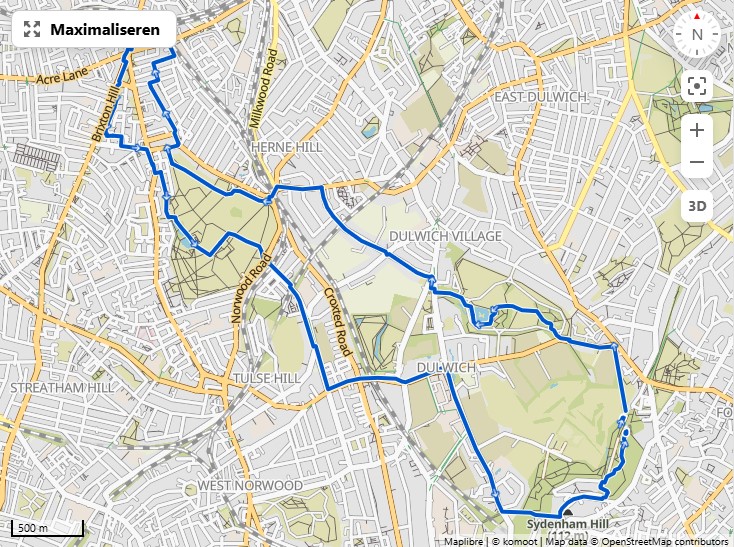
Done this walk in 2023, with a detour in Sydenham Hill Woods due to track works.
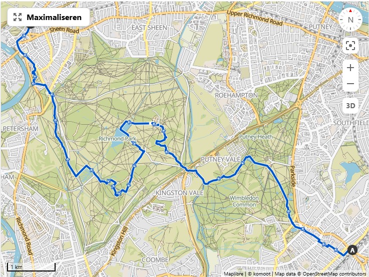
Richmond area
Start- and end points
- Wimbledon station (zone 3): On the District line.
- Richmond station (zone 4): On the District Line, the Overground, and South Western Railways
Own walks
-
GPX Wimbledon to Richmond (15km) from Wimbledon station to Richmond station.
Other options
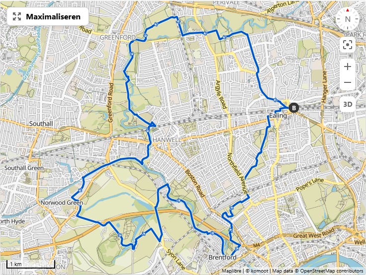
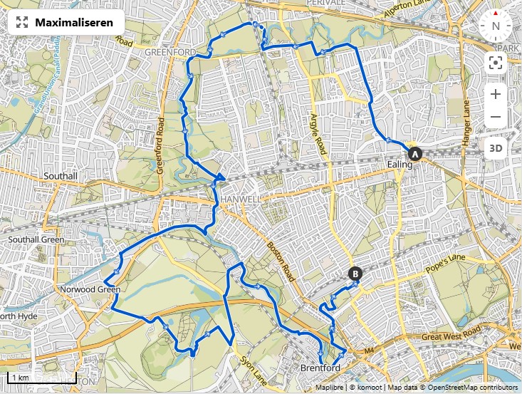
Ealing
Start- and end points: - Ealing Broadway Station on the Elisabeth Line - Northfields Station on the Picadilly line - Boston Manor Underground Station on the Picadilly Line
Own preparations for a walk over Brent River Park, Wharncliffe Viaduct, Brunel's Three Bridges across the Thames, Osterly House, Blondin Park nature reserve. Walks revised after doing the round trip in 2024.
-
Round trip from Ealing Broadway Station 22.2km GPX counterclockwise
-
Counterclockwise is advised as then the walk can be shortened at needed via the next two options.
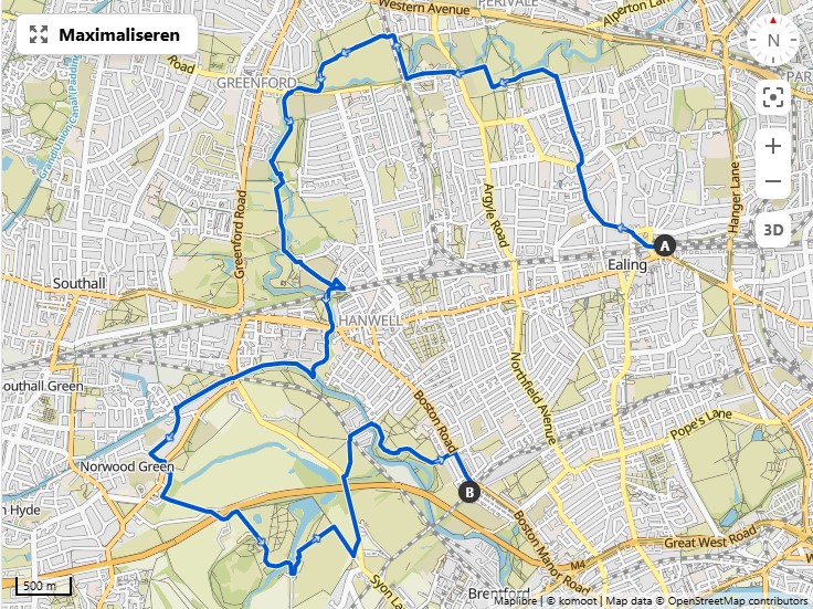
Stops on the way:
-
There is a café at the stables of Osterley House where you can get some sandwiches
-
Just after Osterley House on the main road (assuming the walk is done counterclockwise) there is a pub, the "Hare and Hounds"
-
Close to Ealing Broadway station there is a good craft beer bar, BeerKat.
Walks around Scadbury Park (South-East London)
Start and end points:
Walks from Bickley to Bexley through Scadbury Park:

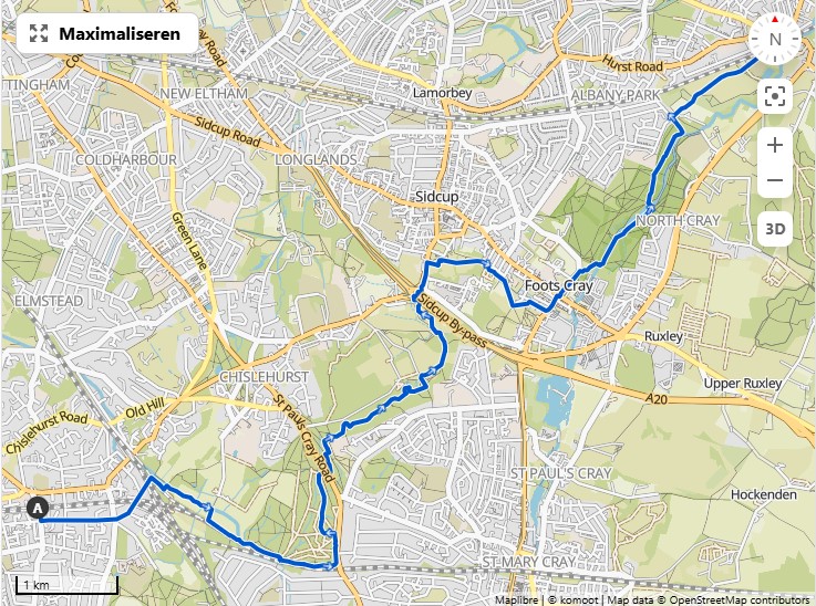
It may be wise to start from Bickley as then quite late in the walk you can still chose between the shorter and the longer one (at Five Arches Bridge)
Other suggestions:
- A walk circular walk from Bexley Station taken from Komoot: Walk along Five Arches Bridge and Joydens Wood, counterclockwise 8,8km and clockwise
Interesting online documented walks
-
The Thames Path: A national trail that starts at the sources in the Cotswolds, but there is a stretch through London all the way to Woolwich.
- See also a page on Walking Britain
- See also a page on gpc-routes.co.uk
-
RouteYou: London City Views Ring Walk: 16 stages, all from station to station
- Section 1: Harrow-on-the-Hill to West Hendon (10.6km) (view on RouteYou)
- Section 2: West Hendon to Golders Green (7.39km) (view on RouteYou)
- Section 3: Golders Green to Highgate Tube Station (10.6km) (view on RouteYou)
- Section 4: Highgate station to Stoke Newington (13.4km) (view on RouteYou)
- Section 5: Stoke Newington to Stratford International (7.49km) (view on RouteYou)
- Section 6: Stratford International to Beckton (11,4km) (view on RouteYou)
- Section 7: Beckton to Woolwich (8,17km) (view on RouteYou)
- Section 8: Woolwich to Charlton (10.1km) (view on RouteYou)
- Section 9: Charlton to Lewisham (8.86km) (view on RouteYou)
- Section 10: Lewisham to Numhead (10.4km) (view on RouteYou)
- Section 11: Nunhead station to Crystal Palace (11.8km) (view on RouteYou)
- Section 12: Cristal Palace to Streatham (12.4km) (view on RouteYou)
- Section 13: Streatham to Wimbledon (10.6km) (view on RouteYou)
- Section 14: Wimbledon to Richmond (12.5km) (view on RouteYou)
- Section 15: Richtmond to Ealing (10.2km) (view on RouteYou)
- Section 16: Ealing to Harrow-on-the-Hill (11,9km) (view on RouteYou)
-
RouteYou: London Tube Ends Ring Walk - Unfinished project when we updated this for the last time
- Section 1: Epping to Cheshunt (15.2km) (view on RouteYout)
- Section 2: Cheshunt to Chingford (14.6km) (view on RouteYou)
- Section 3: Chingford to Enfield (14.7km) (view on RouteYou)
- Section 4: Enfield to Cockfosters (13.9km) (view on RouteYour)
- Section 5: Cockfosters to High Barnet (6.2km) (view on RouteYou)
- Section 6: High Barnett to Mill Hill East (7.89km) (view on RouteYou)
- Section 7: Mill Hill East to Edgware (10.2km) (view on RouteYou)
- Section 8: Edgeware to Stanmore to Harrow & Wealdstone (12km) (view on RouteYou)
- Section 9: Harrow & Wealdstone to Watford Junction (15.6km) (view on RouteYou)
- Section 10: Watford Junction to Little Chalfont (15.7km) (view on RouteYou)
- Section 11: Litle Chalfont via Chesham to Amersham (14km) (view on RouteÝou) (Nog geen GPX gedownload)
- Section 12: Amersham to Rickmansworth (16.2km) (view on RouteYou)
- Section 33: Barking to Romford (18.5km) (view on RouteYou)
- Section 34: Romford to Upminster (11.1km)
-
More official is the 15-stage Capital Ring Walk by TfL (stored on Komoot)
-
Capital Ring Walk on Ramblers Inner London with an overview of the stations and PDFs with guides.
-
Green Chain Walk in Sout-East London
-
The Green London Way (AllTrails version) (GPX from AllTrails) is yet another circular trail around London
-
15-mile Green Link Walk from Epping Forest to Peckham Town also looks interesting. (GPX from gps-routes.co.uk) (Stored on Komoot)
PDFs with descriptions from the Go Jauntly app:
-
Some paths found on AllTrails:
- The Wandle Trail (19.6km) (GPX from AllTrails)
(stored on Komoot)
- Starts near West Croydon station (Overground & Southern)
- Ends near Wandsworth Town Station (Sout Western)
- East Putney Tube Station (District line) could be an option too.
- The Wandle Trail (19.6km) (GPX from AllTrails)
(stored on Komoot)
At the border of London
Further out-of-town hikes
Sources:
Maybe interesting hikes:
-
Leith Hill can be done from Holmwood Station.
-
Chess Valley Walk from Chesham Station at the end of the Metropolitan Line (but outside the big ringroad around London) to Rickmansworth Station, also on the Metropolitan Line.